|
The greenbelt, as Austinites commonly refer to it, is actually the Barton Creek Greenbelt. It contains a little more than 12.5 miles of fantastic trails. Year round, this is a great place to go hiking, running, or biking. Additionally, there are a number of great spots to go rock climbing as limestone cliff faces often line the trails along the greenbelt. However, when there's enough rain, a number of wonderful swimming holes arise, and one can also go tubing or kayaking.
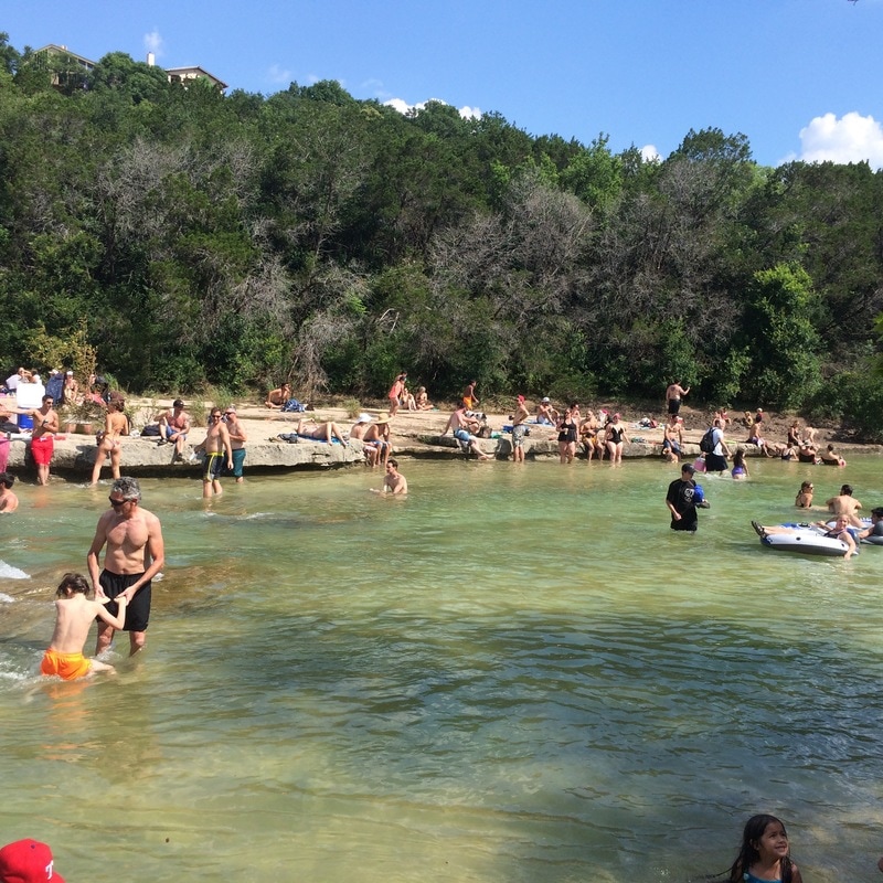
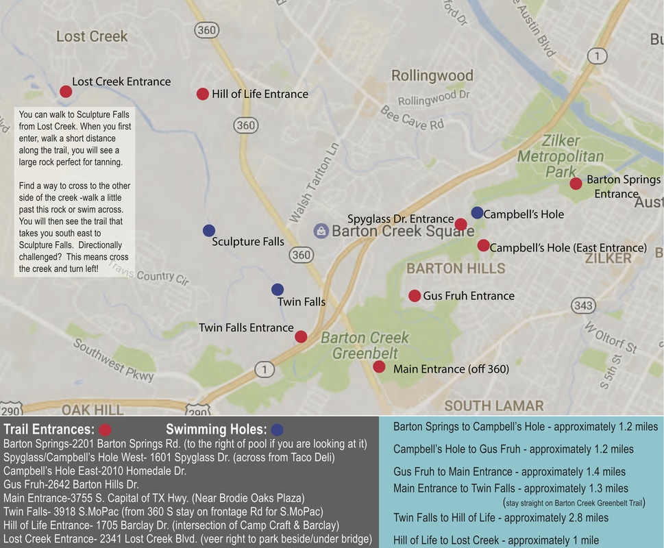
My map below highlights the different access points and swimming holes found in one of Austin's most treasured places, the greenbelt. Since we don't usually get a ton of rain in Austin, some of these swimming holes may be dry at certain points. In my experience, the north western swimming holes, such as the one by the Lost Creek entrance and Sculpture Falls, tend to hold water better than the south eastern Campbell's Hole. Campbell's Hole (pictured above)tends to be shallower and offer intense currents, especially after a large rain fall. The entire trail is great for hiking and biking; however, the Twin Falls entrance offers a bit more variety if you are mountain biking. If you enter through the Spyglass entrance and turn right, there are a few good climbing spots, and the main entrance off 360 near the Brodie Oaks Shopping center is also popular among climbers. It is important to note that a number of these Austin greenbelt access points are located in residential neighborhoods. Please be respectful, and don't forget to take home whatever you brought in with you!
1 Comment
|
BLOGSharing Austin real estate updates, home owner tips, & more. Archives
February 2024
Categories
All
|


